
Exploring the Enigma of Mount Rainier: An Unpredictable Future for Pacific Northwest Volcanoes
- Mario Magana

- Dec 20, 2024
- 3 min read
Known for its stunning beauty and formidable presence, Mount Rainier is an iconic symbol of the Pacific Northwest. Towering at 14,411 feet, it is the highest peak in Washington State and one of the most glaciated mountains in the contiguous United States. However, beneath its breathtaking façade lies the complexity of a contemporary volcanic system that can awaken at any moment.
As we delve into the mysteries of Mount Rainier, it is essential to understand key aspects of its geology, the potential impact of an eruption, and the likelihood of other volcanoes in the region becoming active.
The Significance of Mount Rainier
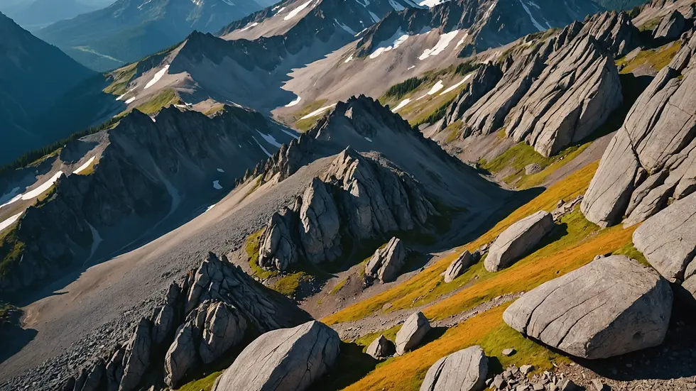
Mount Rainier is not just a popular destination for hikers and climbers; it also serves as an important natural laboratory for understanding volcanic activity and the Earth's geological history. Its combination of volcanic and glacial features provides unique insights into the dynamic processes that shape our planet.
The mountain has been dormant since its last significant eruption 1,000 years ago, but it is categorized as a stratovolcano, which means it has the potential to erupt violently. Its composition primarily consists of andesite, a type of rock formed from the slow cooling of magma beneath the Earth's surface.
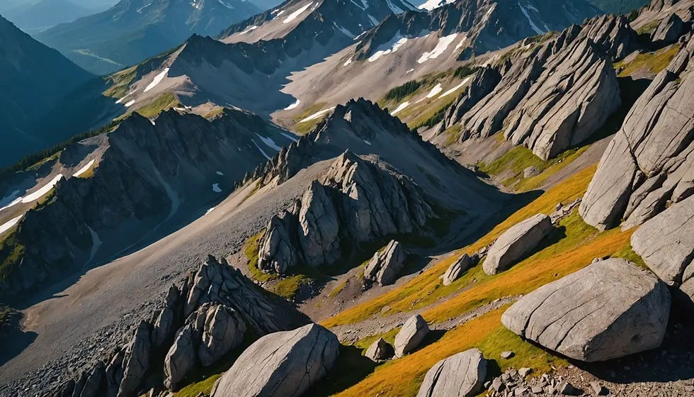
Mount Rainier is surrounded by numerous glaciers, which continually reshape its landscape, making it an area of significant natural wonder. The National Park surrounding this volcano offers visitors an opportunity to explore its diverse ecosystems while raising awareness of the geological processes at play.
What Would an Eruption Look Like?
Should Mount Rainier awaken, the consequences could be devastating. An eruption could send ash clouds thousands of feet into the atmosphere, affecting air travel and human health. Ash fallout could blanket nearby towns and cities, causing disruption to everyday life. Moreover, the melting glaciers would likely lead to the formation of lahar flows—volcanic mudflows that could travel swiftly down the mountainsides, devastating everything in their path.
The impact level would depend on various factors, including the scale of the eruption and the prevailing weather conditions. A pyroclastic flow—a mixture of hot gas, ash, and volcanic rock—could reach speeds of up to 700 mph, further illustrating the potential dangers. While major eruptions are not common, the threat of an eruption still hangs in the balance, warranting enhanced monitoring and preparedness efforts in the region.
The Next Potential Eruption: Neighbors of Mount Rainier
While Mount Rainier's activity is closely monitored, other volcanoes in the Pacific Northwest pose their own risks. For example, Mount St. Helens, located 50 miles to the north, famously erupted in 1980, resulting in significant geological and ecological changes in the region. Another contender is Mount Baker, which has shown signs of unrest and is also regarded as a high-risk volcano.
Geologists continue to study these volcanoes, evaluating seismic activity and gas emissions as indicators of potential eruptions. While predicting volcanic eruptions remains a difficult science, ongoing research helps to inform both local communities and policymakers about possible scenarios.
Volcanic Monitoring and Preparedness
Ever since the catastrophic events of Mount St. Helens, monitoring for signs of volcanic activity has become more sophisticated. Agencies like the United States Geological Survey (USGS) collaborate with local authorities to enhance early warning systems. These systems gather data from seismographs, GPS stations, and satellite imagery to track ground deformation and other volcanic activity indicators.
Employing technology allows scientists to provide valuable information about any changes that might suggest a future eruption. Local communities are often educated on how to prepare for such events, which might include evacuation plans, emergency kits, and real-time alerts.
Be Prepared: Stay Informed
Given the unpredictability of active volcanoes, it is crucial for individuals living in or visiting regions near Mount Rainier and other volcanoes to remain informed. Understanding evacuation routes and emergency procedures can be life-saving in the event of an eruption or lahar flow.
Additionally, keeping track of geological reports and alerts through resources like the USGS website ensures that you stay aware of the ongoing risks and developments.

Conclusion
Mount Rainier stands as a majestic yet unpredictable giant in the Pacific Northwest. With its potential for volcanic activity and the interconnectedness of nearby volcanoes, understanding the geological features of this region becomes paramount.
While the possibility of an eruption may seem distant, being informed and prepared is essential for those who live near these powerful natural features. Striking a balance between appreciating the beauty of Mount Rainier and recognizing its potential hazards is vital for ensuring personal safety and the continued enjoyment of this natural landmark.
As research progresses and monitoring technology improves, we can hope for better preparedness and more refined predictions. The enigma of Mount Rainier will continue to captivate, reminding us of nature's incredible power while urging vigilance and respect for the forces that lie beneath our feet.


Comments